


Moving from climate variables to decision-ready indicators.
Reliable information on the future impacts of climate change is essential for protecting Europe's seas and coasts. Yet existing climate projections often lack the level of detail needed to support decisions at basin and coastal scales. RIVIERADE addresses this challenge by moving beyond generic climate variables and by developing a sustainable and replicable scientific framework that transforms climate projections into targeted, decision-ready indicators, at a spatial resolution better tailored to the end user's needs and covering the decadal to multi-decadal horizons.
The project's methodology follows a circular workflow, from understanding user needs to developing advanced simulations and assessing, validating and translating them, in collaboration with users, into practical applications across various spatial scales and time horizons: three European sea basins, four coastal regional areas and four local use cases, from few decades from present to the end of the century.
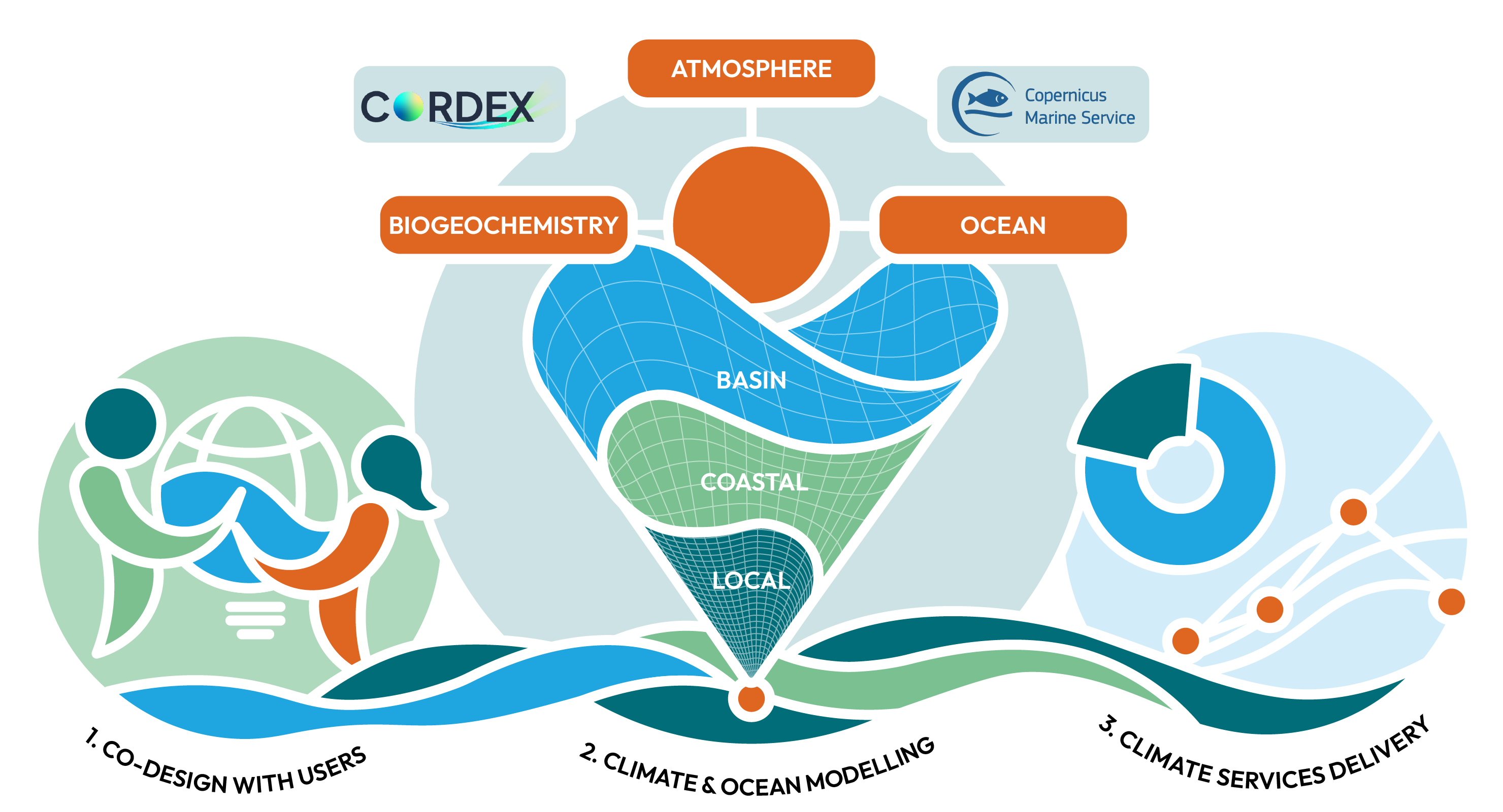
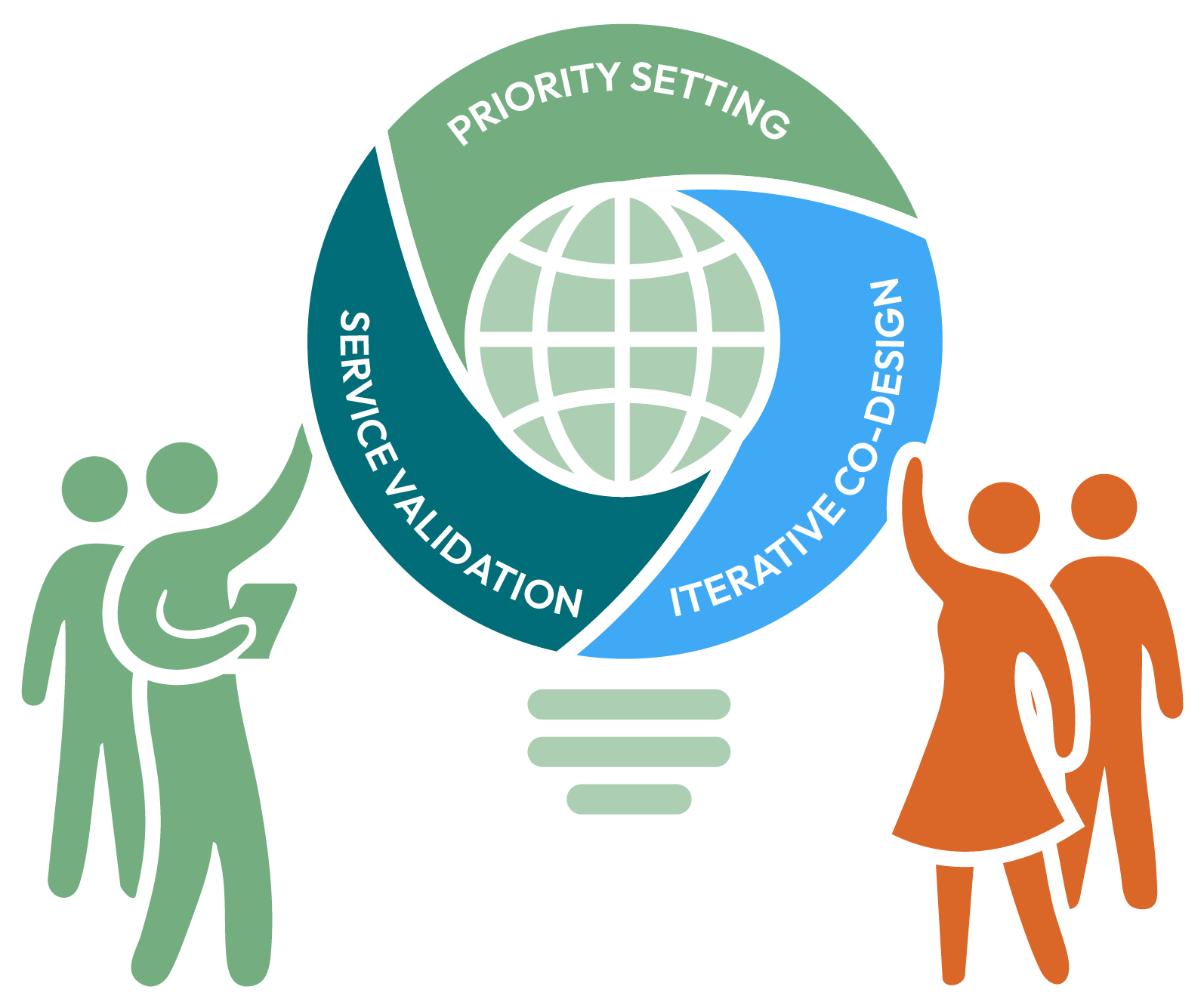
Climate services are most effective when they are developed with, rather than simply for, the people who will use them. RIVIERADE embeds stakeholder and end-users engagement throughout the project, ensuring that scientific priorities, service requirements and validation are guided by continuous dialogue with the communities dedicated to managing Europe's seas and coasts, advancing marine spatial planning, assessing coastal risks, and driving the sustainable development of the blue economy.

Identify priorities together with policymakers, environmental agencies, coastal managers and blue economy stakeholders.

Co-develop and refine climate services through an iterative process of feedback and validation.

Ensure scientific outputs remain relevant, practical and ready for real-world application.
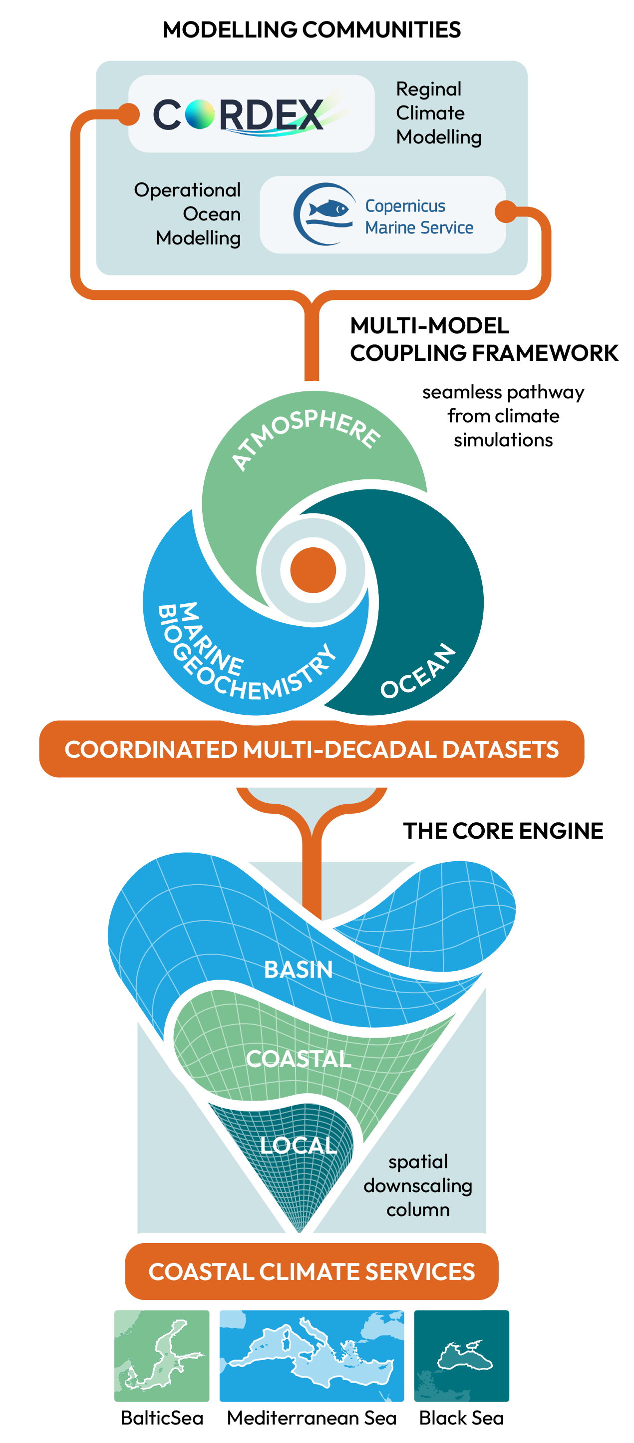
At the heart of RIVIERADE lies the development of a pre-operational, replicable, coordinated multi-model framework designed to connect climate research with practical applications. By bringing together complementary modelling communities and integrating atmosphere, ocean physics and biogeochemistry across multiple spatial and temporal scales, the framework aims to create a seamless pathway from climate simulations to coastal climate services.

Bringing together European leading climate and operational ocean modelling communities within a common scientific framework.

Coupling atmosphere, ocean physics and biogeochemistry to generate coordinated, high-resolution, multi-decadal datasets for the Baltic, Black and Mediterranean Seas.

Applying high-resolution downscaling to translate basin-scale decadal predictions and multi-decadal projections into detailed information for regional and coastal climate assessments.
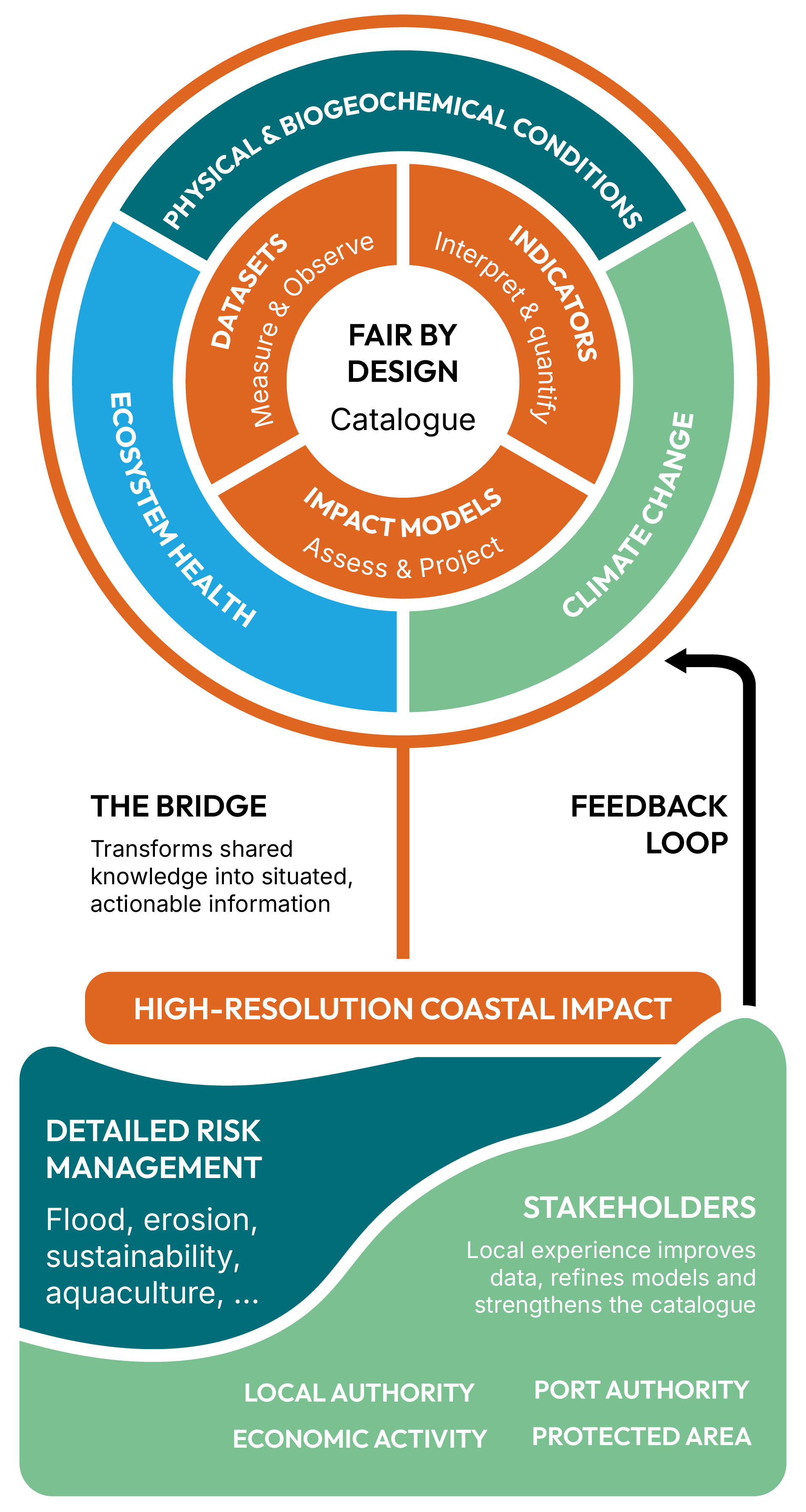
The scientific workflow culminates in a range of datasets, indicators, impact models and climate service demonstrators that translate advanced modelling into practical applications. Together, these outputs will form the FAIR-by-design RIVIERADE Catalogue and contribute to the project's long-term legacy, supporting future coastal climate services, integration with the EU Digital Twin of the Ocean and potential implementation within a Copernicus Services framework.

Provide harmonised information on physical and biogeochemical conditions, ecosystem health and climate change across the Baltic, Black and Mediterranean Seas, supporting basin-scale assessments and policy implementation.

High-resolution impact models assess flooding, erosion and other climate-related risks by downscaling basin-scale information to vulnerable coastal regions.

Co-designed with users and stakeholders, local demonstrators apply RIVIERADE's climate services to support coastal risk management and key blue economy sectors such as aquaculture, fisheries and tourism.
RIVIERADE is officially endorsed as a Project of the UN Decade of Ocean Science for Sustainable Development (2021–2030) under the title Delivering Climate Services for European Seas. Hosted by the CoastPredict Programme, the project contributes to the Ocean Decade vision by advancing co-designed, high-resolution climate services that support healthier, more resilient seas and coasts across Europe.
From the semi-enclosed Mediterranean to the seasonally ice-covered Baltic and the rapidly changing Black Sea, RIVIERADE develops and tests its methodology across three distinct marine environments. Within these basins, the project focuses on four selected coastal regional areas — the Adriatic Sea, the Swedish Coast, the Marmara Sea and the Southern Black Sea — providing a diverse testing ground for climate services that can be developed at basin, coastal regional and local scales.
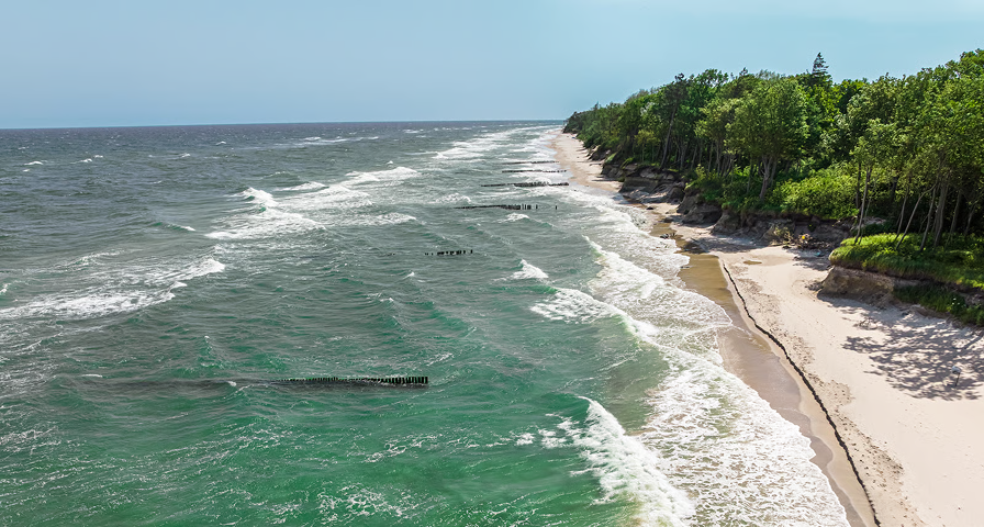
A vulnerable sea shaped by climate and freshwater
The Baltic is a semi-enclosed, brackish sea where climate change interacts with freshwater inputs, sea ice and eutrophication. These unique characteristics make it particularly sensitive to environmental change and an ideal test case for improving regional climate and marine ecosystem modelling.
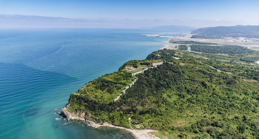
A rapidly changing marine ecosystem
The Black Sea is characterised by its enclosed basin, strong river influence and unique biogeochemistry. Climate change is expected to affect circulation, ecosystem dynamics and coastal environments, making reliable projections essential for sustainable management and regional resilience.
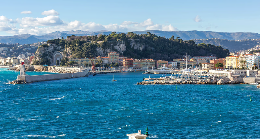
A biodiversity hotspot under increasing climate pressure.
The Mediterranean is one of the world's fastest-warming seas, facing rising temperatures, marine heatwaves, acidification and growing pressure on ecosystems and coastal communities. Its environmental diversity and intense human activity make it an important laboratory for developing climate services that support sustainable management and the blue economy.